Public sample · grower identity and coordinates removed. The original grower report is unchanged.
Ground Scouting Report
Public sample
16
Rows scanned
1.69 km
Of row covered
155
Marked by operator
5.8
In-row marks per 100 m of row
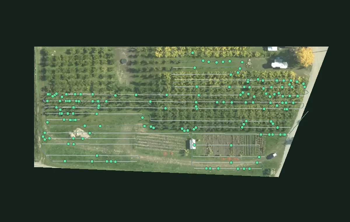
Found: 155 marked spots along 16 rows (1.69 km of row covered).
Look first: Row 05, 22 marked spots (12.7 per 100 m of row).
Map
40 marked areas with photos from the source report
Each pin links an operator mark to its photo in the source report. Tap a pin or marked area to inspect it.
1Marked moundMarked stretchPhoto
Where to look first
| Row | Marks | Per 100 m | |
|---|---|---|---|
| Row 05 | 22 | 12.7 | |
| Row 06 | 9 | 5.6 | |
| Row 04 | 9 | 5.2 | |
| Row 15 | 8 | 4.9 | |
| Row 11 | 7 | 5.0 |
Rows 05, 06 and 04 hold 40 of the 99 marks in the rows (40%). 56 more are off the rows (see the map).
How this report is made
- CartPushed along the rows by a person; records video and GPS.
- Operator marksA person presses a button at each mound they see.
- ReviewEach mark gets a photo from the cart camera, checked by the operator.
- ReportThe map, photos and this page are built from the marks.
About this report
- Operator marks
- Locations marked by the operator during a cart pass.
- Coordinates removed
- The aerial photo is rotated and cropped to the scanned blocks. Grower details, exact dates and geographic coordinates have been removed. Imagery: Regional District of Central Okanagan, 2018 (OBWB, GeoBC). Contains information licensed under the Open Government License – Regional District of Central Okanagan. Row labels are anonymous. Row placement and distances are approximate.
- Leads, not proof
- Each mark is a spot to check on the ground, not a confirmed gopher or active burrow.